
RECOVERED FROM THE ORIGINAL SITE
Canadian River.
Same muddy memories.
A look back at the Canadian River page preserved in the TXMUD website backup.

What the old page remembered.
The listing described rock climbing, sand drags, mud in river bottoms, streams and scenery, with primitive camping. It linked to a report titled “Sand Drags 2002” and mentioned the Amarillo Sand Drag Association and West Texas Outlaws as past event hosts.
These are details from the archived page, not a current event calendar or confirmation of today’s camping and riding access.
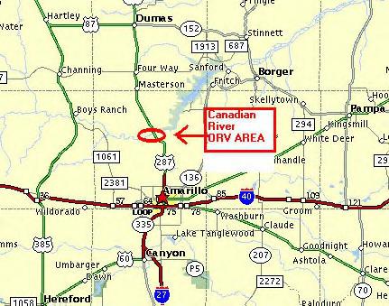
A reference, not a riding permit.
The archive’s acreage, fees, helmet statements, directions and event dates have not been verified for present-day use. The old page describes a wider Canadian River area; do not treat its locator as permission to ride outside designated areas or across neighboring land.
For the modern Rosita Flats guide, use the NPS and TPWD sources, permit requirements, current map notes and closure information linked below.
Read the current Canadian River / Rosita Flats guide ↗Where this came from.
Recovered from txmud.com/mainwebsite_html/trails/nt/canadianriver.html in the owner’s Texas Mud Backup archive. The banner and locator were stored with that page. The snapshot date is unknown; the page’s link to a 2002 report does not establish when the page itself was written.
This historical reference preserves selected information and graphics from the old page.
Browse the old TXMUD trail pages ↗